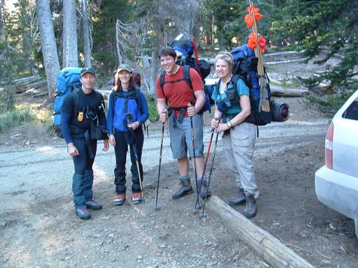
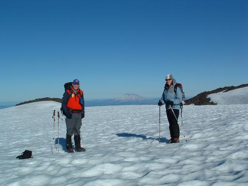
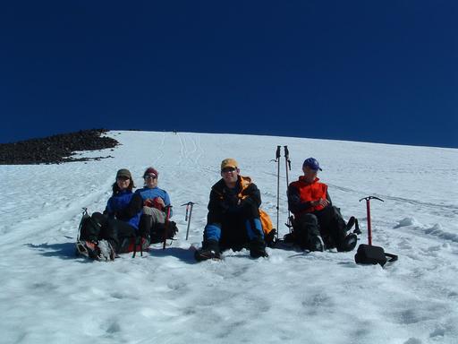
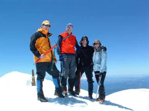
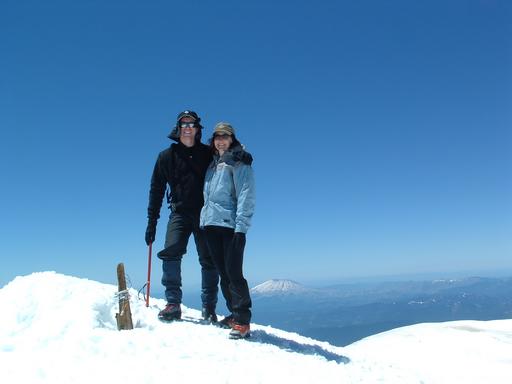
Left to right: me, Dawn, Alex, Pat (Don took the picture.)
[Mount Rainier 1993] [Mount Shasta 1993] [Mount Rainier 1994] [Mount Rainier 1999] [Mount Elbert 2003] [Mount St Helens 2003] [Glacier Peak 2003] [Mount Hood 2003] [South Sister 2003] [Mountaineering Home] [Diversions Home] [Frames] [Home]
At 12,276 ft (3742 m) high, Mt Adams is the second highest peak in Washington State and is the third highest of the Cascade volcanoes (after Mt Rainier and Mt Shasta). It is located in south-central Washington near the town of Trout Lake, very close to the Columbia River and the Oregon border. Our friend Pat Leach organized an expedition to conquer its majestic heights near the end of June. Our group was comprised of Pat, her son Alex, Don Summers, my wife Dawn, and me.
Mt Adams is less than 2 hours away from Portland but at least 5 hours away from Seattle. Unfortunately, Dawn and I were in Seattle for the week prior to our climb and had to suffer the same traffic ordeal as our compatriots. Typically, the fastest route from Seattle shuns the interstate for a network of smaller highways to the east. Some of these highways are marked "Closed in Winter" on the official state highway map. Those are the single lane highways that are mostly dirt. The fastest route to the mountain includes at least 60 miles on those washboard-covered dirt roads. We left from Seattle around mid-day on Friday. Due to a stop to replace some forgotten equipment, heavy traffic, a wrong turn, a required stop at the Ranger Station in Trout Lake, and bad roads, it took us 7 hours to reach our destination.
By the time we were ready to hit the trail, it was almost dusk. We took a quick picture at the trailhead and then hurried up the mountain. Our plan was to follow the standard South Spur route, which proceeds up the southeast side of the mountain. We planned to spend the night on the Lunch Counter, which is a flat area at around 9000 ft (2743 m), and then summit and hike out the next day. It was dark when we reached an altitude of a little over 8000 ft (2438 m). So we stopped and made camp for the night on some relatively flat rocky patches just off of the route. The route was snow-covered with the exception of the first few switchbacks at the beginning of the trail.
Pat sounded the alarm at 5 a.m. She wanted us up and ready to go by 6. By 5, other climbers had already passed near or through our camp site. Don, Dawn, and I were sharing a tent. Don and I grudgingly got up and gathered our gear after much nudging from Dawn, who had been unable to sleep all night and was ready to go.
When we first set out, the sun hadn't warmed the snow long enough to soften it and footing was a little difficult. But the snow soon softened to an almost ideal consistency -- firm enough to support us but soft enough to gain footing, just like we experienced on Mt St Helens several weeks earlier. The first part of the day's ascent covered a moderately steep area leading up to a lengthy, steep headwall. At the top of the headwall was the false summit Piker's Peak. After Piker's Peak, a short flatter area preceeded another 1000-ft-high (305-m-high) headwall. The summit was only 200 ft (61 m) further up a gentle slope at the top of the second headwall.
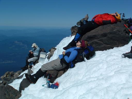
We stopped for a quick snack at the top of the second headwall just before the summit. We were all very tired after our driving ordeal and short night sleeping. While we rested and ate, we watched another climber, who we had met during the ascent, walk dangerously close to a cornice 1000 ft below. The climber in question was not very experienced and we were relieved to see him back away from the cornice before reaching a dangerous point.
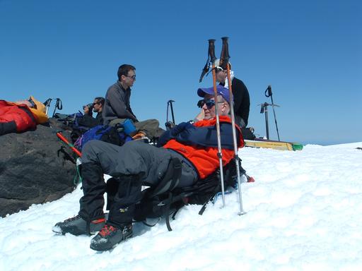
After lunch, we navigated the last 200 ft to the summit. It was warm and sunny with a little bit of wind. It was a very clear day and visibility was amazing. Reaching the summit energized all of us. We posed for photos and gawked at the view. After 20 or 30 minutes on top, we decided that it was time to head back down.
One of the best things about climbing Mt Adams early in the season is the ease of the descent. We were able to glissade down almost the entire distance back to our campsite. Other climbers had brought skis or snowboards. If you climb Mt Adams when there is much snow, come prepared to slide down one way or another. There are few hazards and it is a lot of fun.
As usual, Pat had planted wands every 200 ft until at least the first headwall to help us find our way down. In the time since our successful Mt St Helens climb, Don had acquired a GPS receiver and we were also setting waypoints at each wand. The GPS performed flawlessly and we were very pleased with the tandem strategy of using the GPS and wands for route-finding.
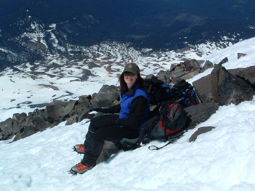
It was very hot at our campsite when we returned. We took a half hour break before packing up for the last leg of our descent. Everyone else used the half hour to sleep. But I used the time to pack up as much as I could and take embarrassing photos. After the half hour was up, we broke camp and hiked out. It was amazing to see how much melting had occurred during our climb. The snow had melted on most of the lower trail and some parts of the trail were even dry.
We were all exhausted and parched when we reached our cars. We quickly threw everything into our vehicles and made our way to Kelly's Trout Creek Inn Bed & Breakfast in Trout Lake, where Pat had booked rooms for the night. Pat had arranged for the proprietors Kelly and Marilyn to make dinner for us and we were all very grateful for warm showers and good food.
We had amazing views of the mountain the next morning and it was fun to look at the route that we had travelled only the day before. The climb was very long and tested our endurance when we were already fatigued. But we were richly rewarded with incredible sights and the very enjoyable company of our friends.
|
| Ready to go after the 7-hour(!) trip from Seattle Left to right: me, Dawn, Alex, Pat (Don took the picture.) |
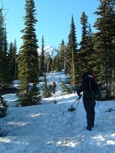 |
| Looking up toward the route through the trees |
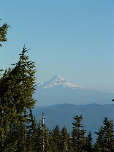 |
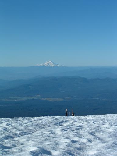
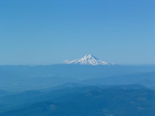
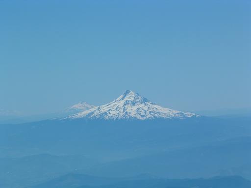
| A glance behind at Mt Hood |
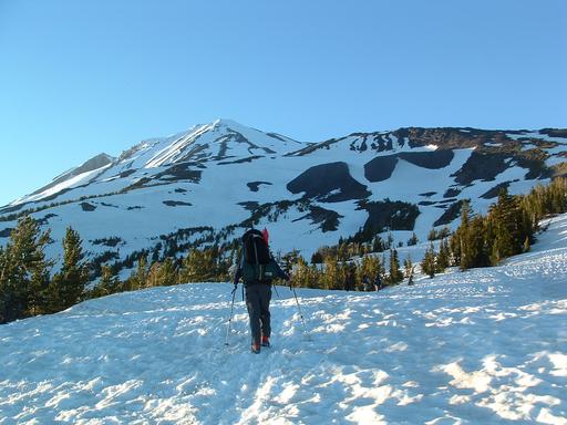 |
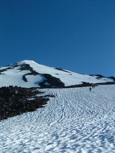
| The route ahead with Piker's Peak and the summit clearly visible |
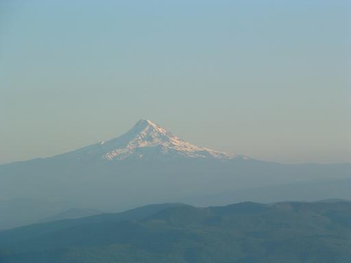 |
| Mt Hood in the hazy twilight |
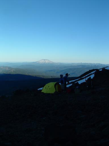 |
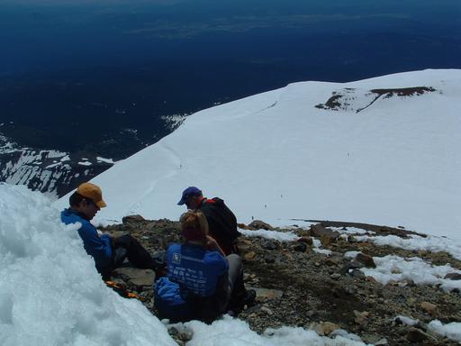
| Pat & Alex discuss our destination in the morning with Mt St Helens eves-dropping |
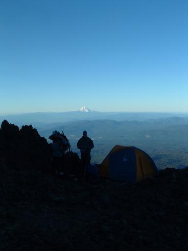 |
| Dawn & Don prepare to break camp |
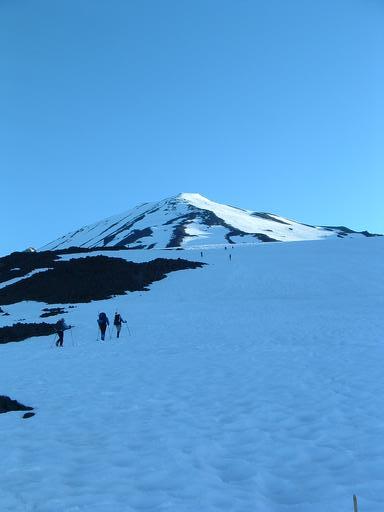 |
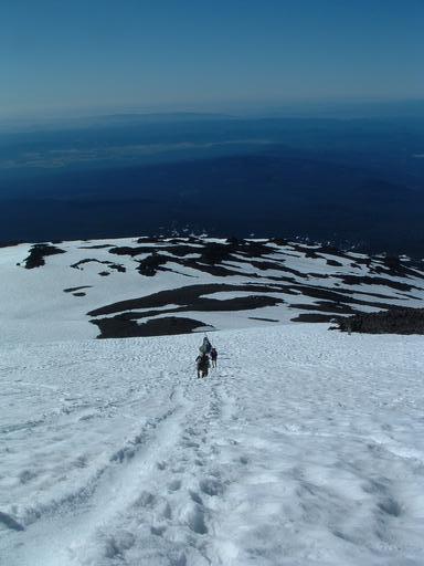
| Pat, Alex, & Dawn head up the snow toward Piker's Peak |
 |
| Skiers come up behind us with Hood and Jefferson in the distance |
 |
| Don, Dawn, & Mt St Helens, which already lies below us |
 |
| We approach the head wall leading to Piker's Peak |
 |
| The parade up the mountain continues with glissading trails on both sides of our route |
 |
| Mt Hood, Mt Jefferson, and the Sisters greet us from Oregon |
 |
| We take a breather on the head wall to Piker's Peak |
 |
| WA & OR or Kenya, sometimes it's hard to tell |
 |
| Hood, Jefferson, and the distant Sisters become clearer as the morning haze dissipates |
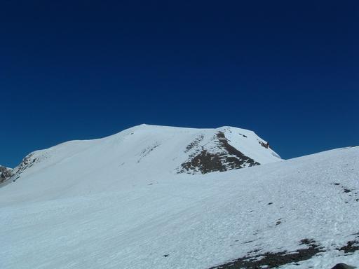 |
| The head wall before the summit -- The route from Piker's Peak |
 |
| Pat & Alex make good use of their time waiting for Mark & Don |
 |
| Sitting in the comfy chair |
 |
| Ah, the perfect rock |
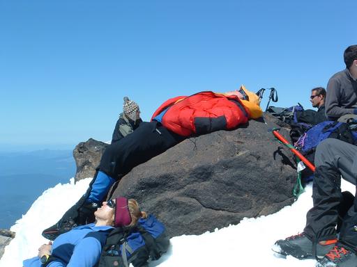 |
| Like a lizard in the sun |
 |
| We tower above Mt St Helens |
 |
| A snack at the top of the head wall above Piker's Peak -- Only 200 ft left to the summit |
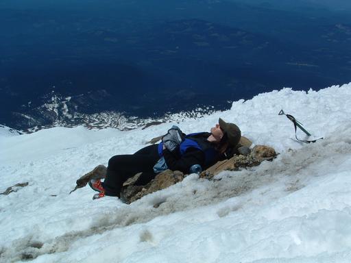 |
| Dreaming of the descent |
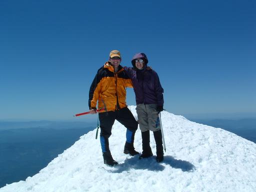 |
| Triumph at the pinnacle |
 |
| The Abominable Snow-Don |
 |
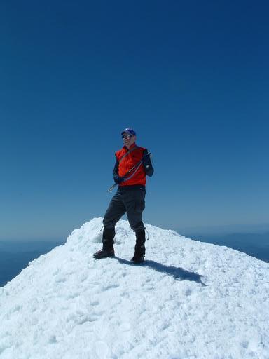
| Never any doubt |
 |
| The "Vision Thing" |
 |
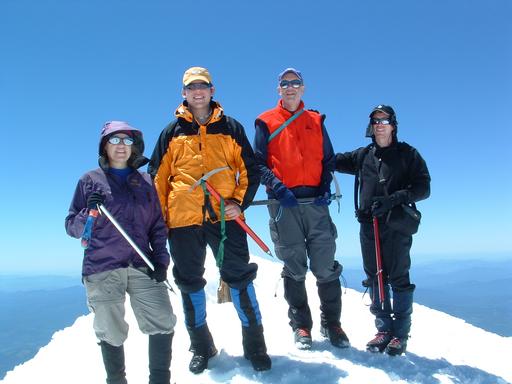
| Let's build a house up here, Honey! |
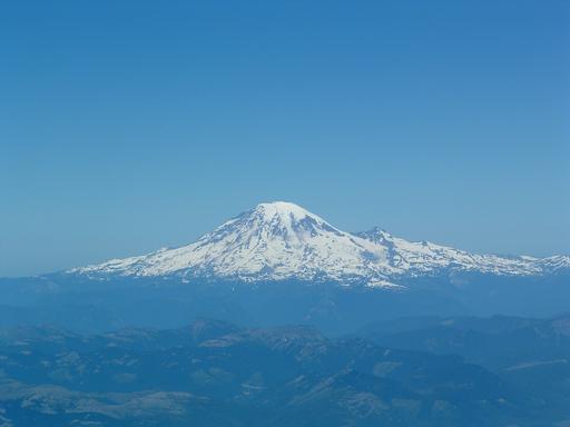 |
| Nearby Mt Rainier doesn't seem much higher |
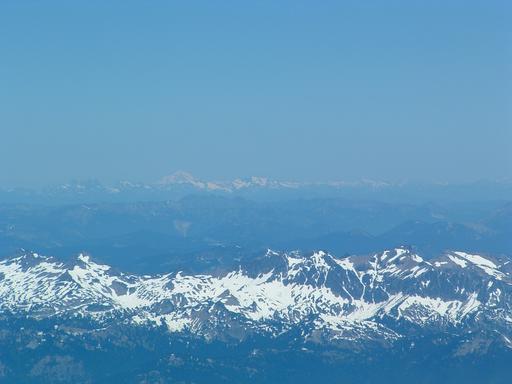 |
| Mt Baker in the distance proves that we can almost see Canada |
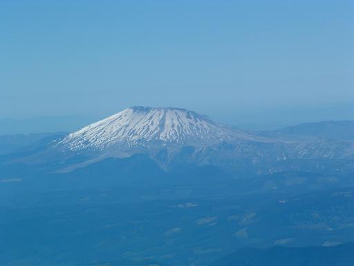 |
| Poor devastated Mt St Helens lies far below |
 |
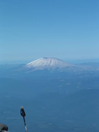
| Hood, Jefferson, and the distant Sisters are spectacular from the summit |
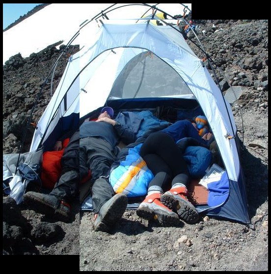 |
| Don takes full advantage of a half-hour break before the final leg of our descent and Dawn joins in the snoozivities |
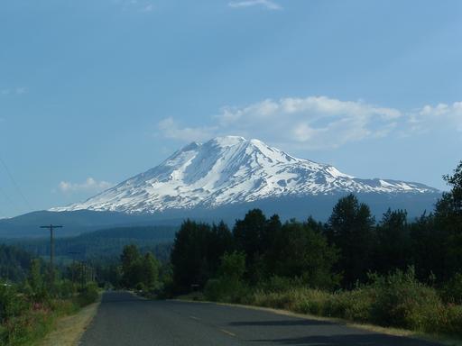 |
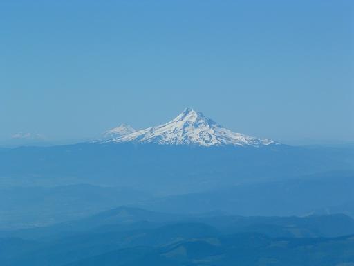
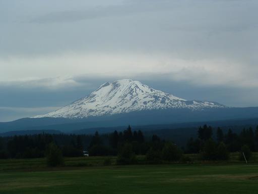
| Mt Adams from Trout Lake on Sunday morning |
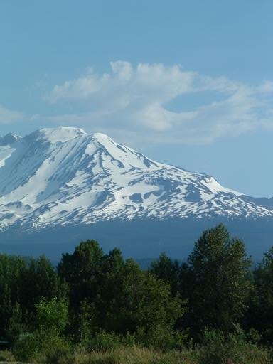 |
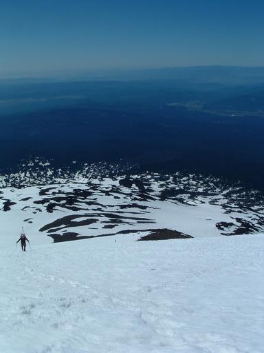
| A close-up of our route to the top |
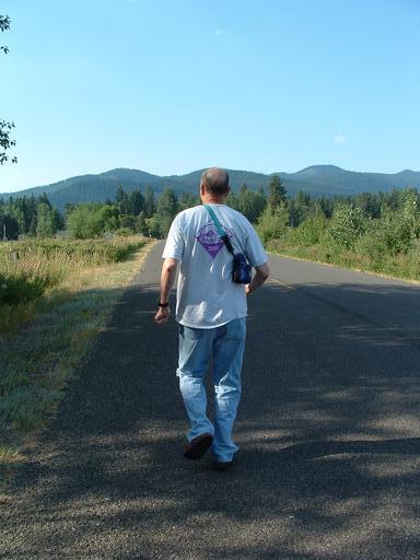 |
| Don attempts to flee as too many bars get the better of his digestive tract. (I'm making this up.) |
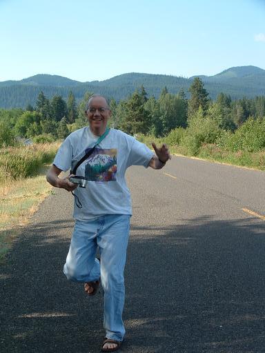 |
| Don does the happy, happy, joy, joy dance in celebration of freedom from the foul bars. |
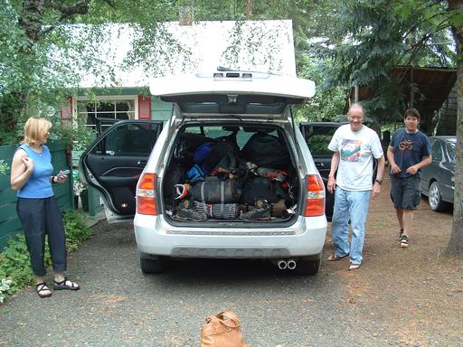 |
| Pat, Don, & Alex ventilate the car from what they hope is a safe distance |
 |
| The weather changes over the mountain as we leave Trout Lake |
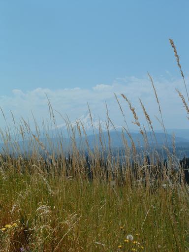 |
| Mt Hood lies in the very tall grasses |
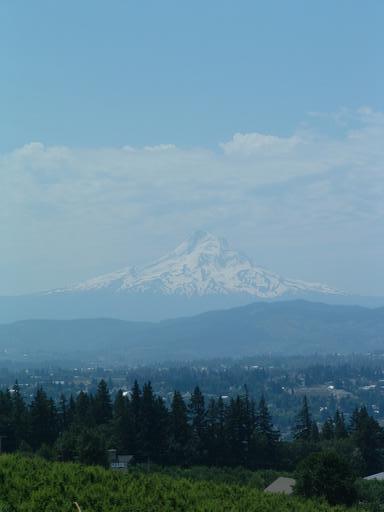 |
| One last Mt Hood shot as we approach the Columbia Gorge |
[Mount Rainier 1993] [Mount Shasta 1993] [Mount Rainier 1994] [Mount Rainier 1999] [Mount Elbert 2003] [Mount St Helens 2003] [Glacier Peak 2003] [Mount Hood 2003] [South Sister 2003] [Mountaineering Home] [Diversions Home] [Frames] [Home]
Mark A. Martin <mark@mark-a-martin.us>
Last modified: Thu Nov 20 07:12:55 PST 2003