[Mount Rainier 1993] [Mount Shasta 1993] [Mount Rainier 1994] [Mount Rainier 1999] [Mount Elbert 2003] [Mount St Helens 2003] [Mount Adams 2003] [Glacier Peak 2003] [South Sister 2003] [Mountaineering Home] [Diversions Home] [Frames] [Home]
At 11,239 ft (3426 m) high, Mt Hood is the 4th highest Cascade volcano and is the highest mountain in Oregon. It is very prominent throughout Northern Oregon and Southern Washington and serves as a symbol and focal point in Portland in the same way that Mt Rainier does in Seattle. As a result of this prominence and its proximity to Portland, Mt Hood is a very popular climb. This popularity is one of the primary hazards of the climb. The mountain can become dangerously crowded and a mistake for one climbing party can lead to tragedy for multiple climbing parties. This is what occurred in the 2002 accident that killed several people.
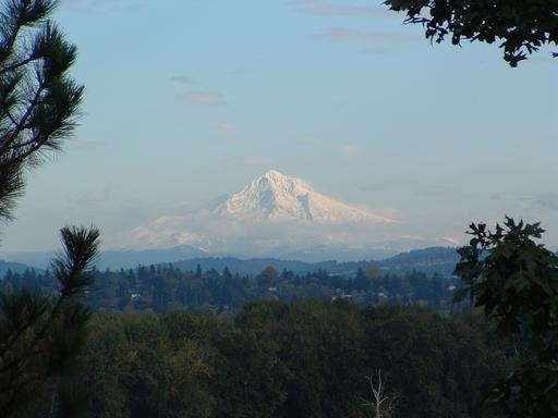
|
| Mount Hood from Portland |
The standard route up the mountain begins at Timberline Lodge on the south side. It travels around the east side of the ski area and up between Crater Rock and the Steel Cliff past a stinky fumerole called the Devil's Kitchen. It continues across a short saddle called the Hogback, across the large Berschrund at the top of the snow field, and then up through either of two chutes called the Pearly Gates. The strong smell of hydrogen sulfide is present from the vicinity of the Devil's Kitchen throughout the remainder of the climb. Please refer to a guide book (or a guide) for further details.
As all of the guide books emphasize, a climb up Mt Hood should not be taken lightly. It should not be attempted without the proper gear, which includes crampons and an ice axe at all times of the year. And one should be willing to turn back if conditions become hazardous. The summit might appear to be very close and easily accessible from Timberline Lodge. But it is much further than it looks and even the standard route from Timberline Lodge contains objective hazards such as frequent rock fall. As a result, it is advisible to have prior mountaineering experience with proper equipment or to be climbing with an experienced guide.
I climbed Mt Hood by myself via the standard route on Wednesday, July 30, 2003. I chose a Wednesday to avoid the crowds and I climbed alone since none of my climbing partners were available to join me. Climbing on a Wednesday turned out to be a good choice. I only encountered 6 other people on the climb -- a party of 2 and a party of 4.
I studied the route carefully and spoke with several people who had previously made the climb before making my attempt. Since I had never climbed Mt Hood before, I was concerned about finding the route. So I began my climb at sunrise, which was around 6 a.m. As the sun warms the mountain, rock fall becomes more likely. So this choice was balancing the hazard of finding the route with the increased likelyhood of rock fall.
I witnessed a vivid example of the hazard of rock fall on the route. As I was enjoying a brief lunch on the Hogback, a huge mass of rock came flying off of the Steel Cliff, landing near the Devil's Kitchen below me. The noise was very unnerving and provided strong motivation for completing my expedition rapidly.
The high temperature in Portland that day was 103°F (39.4°C) and it was a beautiful, warm day on the mountain. Conditions on the mountain were very pleasant and I was happy to escape the heat at lower altitudes for a while. As you can tell from the photos below, it was close to being a perfect day.
Just prior to our trip on Glacier Peak, we acquired a Magellan SporTrak Pro handheld GPS receiver. We have found the GPS to be very helpful for route finding, particularly on descents. The GPS data on Glacier Peak was very noisy since heavy tree-cover prevented the reception of clear signals from the satellites. But there are only a few trees near the bottom of the standard route on Mt Hood and I was able to obtain very clean data for my entire climb.
The GPS data from my climb is available here. After scrutinizing the data, I arrived at the following stats.
| start | 5895 ft at 6:00 a.m. |
| summit | 11,244 ft at 9:50 a.m. |
| finish | back at 5895 ft at 12:20 p.m. |
| elevation gain | 5349 ft |
| time to summit | 3 hrs 50 min |
| total distance travelled | 6.64 mi |
| total time | 6 hrs 20 min |
The summit altitude is a little higher than the official height of the mountain possibly because I was holding the GPS receiver in my hand at about chest level. Also, altitudes from the receiver are only accurate to within 3 meters.
As an avid Linux user and free software advocate, I used a free Tcl/Tk program called GPSMan to analyze and depict the GPS data. GPSMan includes facilities for creating 3-dimensional representations of tracks and routes, elevation profiles, 2-dimensional bird's-eye projections of tracks and routes, and speed profiles for tracks and routes. I am including examples of some of these for my ascent below. In the figures, elevations are listed in meters.
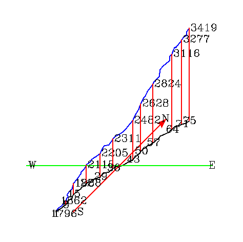 |
| Three-Dimensional Representation of My Ascent |
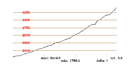 |
| Elevation Profile of My Ascent |
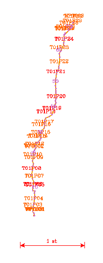 |
| Bird's-Eye View of the Route (Scale = 1 mi) |
The ascent was fairly uniform, except for the last thousand feet, which were considerably steeper. The summit was devoid of snow and the last thousand feet also contained a tricky transition zone between snow and ice and rock and volcanic ash.
Without further ado or further narrative interruption, here is a selection of the pictures that I took during my climb.
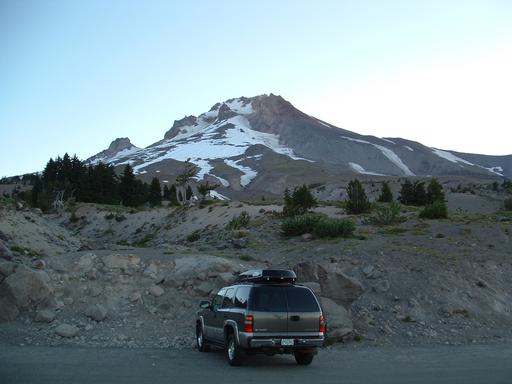 |
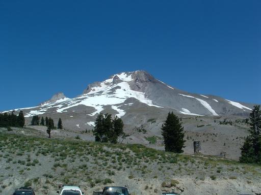
| A distant summit: The south side of Mt Hood from the parking lot at Timberline Lodge just before sunrise around 6 a.m. |
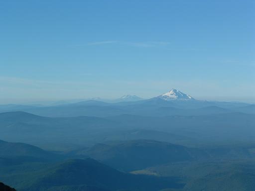 |
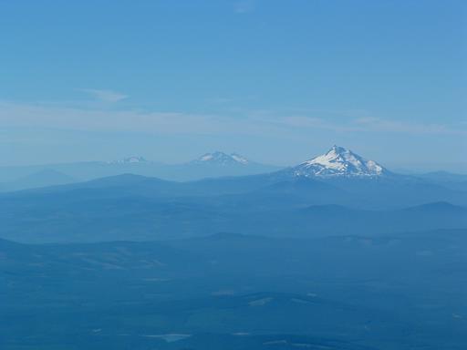
| Mt Jefferson and the Sisters from the ski area |
 |
| The view to the south after leaving the ski area far behind |
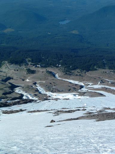 |
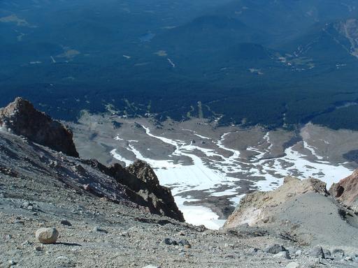
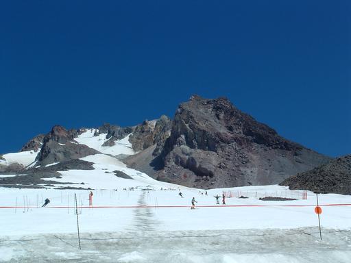
| The ski area and Timberline Lodge |
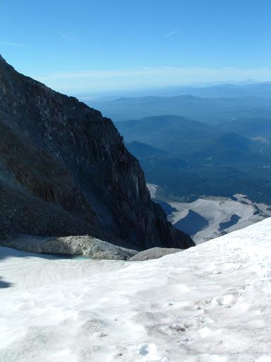 |
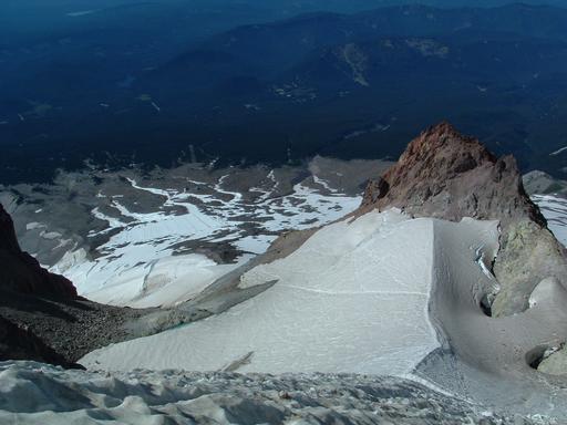
| The Steel Cliff, the Devil's Kitchen, and beyond from the Hogback |
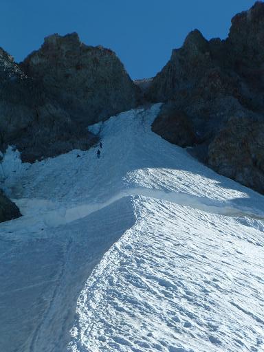 |
| The Hogback, the Bergschrund, and the Pearly Gates: The last 1000
and most challenging feet (Notice the party of 4 making their descent.) |
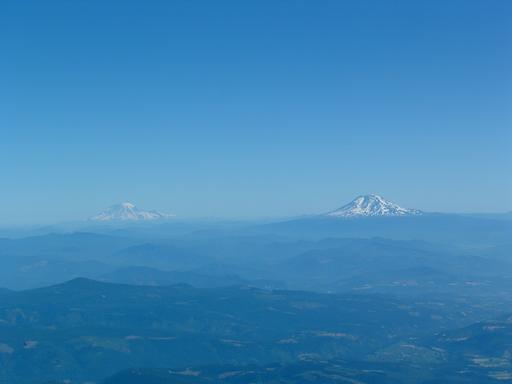 |
| The Twins: Mt Rainier and Mt Adams |
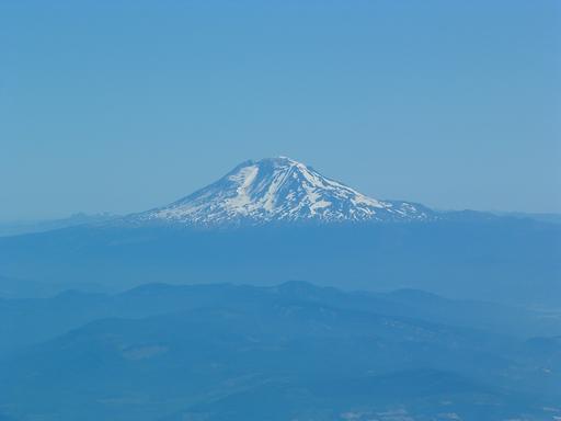 |
| Mt Adams |
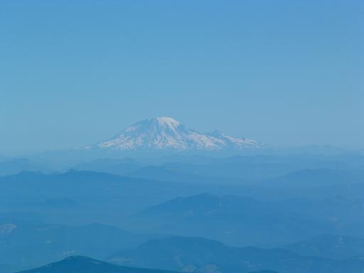 |
| The more distant Mt Rainier |
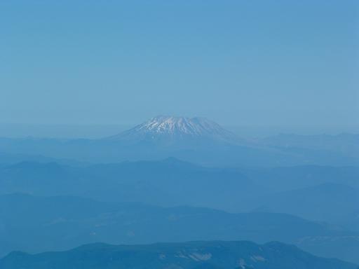 |
| A murky Mt St Helens |
 |
| From whence I came: A lilliputian Timberline Lodge |
 |
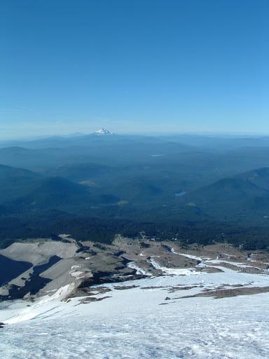
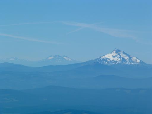
| A clearer view of Jefferson and the Sisters |
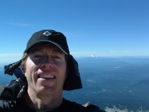 |
| The arms-length-cam summit shot with Jefferson & the Sisters |
 |
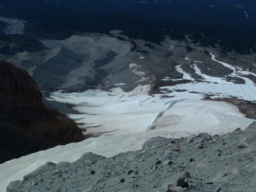
| The Hogback and Bergschrund from just below the Pearly Gates |
 |
| Crevasses on the adjacent Newton Clark Glacier |
 |
| Jefferson & the Sisters loom clearer and closer just above the ski area |
 |
| A look back from the ski area |
 |
| The mountain in full daylight from the parking lot |
[Mount Rainier 1993] [Mount Shasta 1993] [Mount Rainier 1994] [Mount Rainier 1999] [Mount Elbert 2003] [Mount St Helens 2003] [Mount Adams 2003] [Glacier Peak 2003] [South Sister 2003] [Mountaineering Home] [Diversions Home] [Frames] [Home]
Mark A. Martin <mark@mark-a-martin.us>
Last modified: Thu Nov 20 07:12:55 PST 2003