[Mount Rainier 1993] [Mount Shasta 1993] [Mount Rainier 1994] [Mount Rainier 1999] [Mount Elbert 2003] [Mount St Helens 2003] [Mount Adams 2003] [Glacier Peak 2003] [Mount Hood 2003] [Mountaineering Home] [Diversions Home] [Frames] [Home]
The Three Sisters are three Cascade volcanoes that form a chain connected by ridges and serve as the centerpiece of the Three Sisters Wilderness. Three Sisters Wilderness lies near the city of Bend in Central Oregon. At 10,358 ft (3157 m) tall, the South Sister is the tallest of the Sisters and the third highest peak in Oregon, after Mt Hood and Mt Jefferson.
Although the South Sister is glaciated, the standard routes up the mountain are well-marked trails that avoid the glaciers and are free from snow for much of the climbing season. As a result, the South Sister is generally considered to be the easiest of the Cascade volcanoes to climb and is very popular due to its accessibility and the nice views that it provides. The climb is relatively easy but the standard routes are reasonably long. So many people choose to spread the climb over 2 days, spending a night camping part-way up.
My wife Dawn and I had been saying that we were going to climb the South Sister for months when we finally decided that the time was right. On Saturday, October 4, 2003, we threw everything into the car and drove to Bend. We spent the night in Bend. Then, on Sunday, we made our ascent and drove back to Portland.
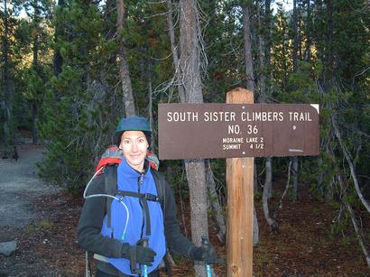
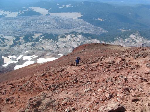
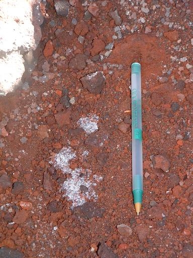
We parked near the trailhead at Devil's Lake and followed the South Sister Climbers Trail to the summit. A Northwest Forest Pass is required to park in the lot at Devil's Lake. Our climb took around 8.5 hours round-trip, ascending (and descending) approximately 5000 ft (1524 m) over a distance of around 11.5 miles (18.5 km). The trail begins in the woods, levels out for a stretch through an open, mostly treeless area, and then heads up through volcanic ash and scree, skirting the edge of the moraine of the Lewis Glacier. The terrain around the moraine is a beautiful iron-rich red color and there is foamy gray obsidian glass scattered throughout. The summit crater is large and the trail reaches the lip of the crater at a point almost opposite to the true summit. Once you have reached the crater lip, you get to the true summit by following a trail that runs around the circumference of the crater.
I will relate one cautionary tale. At the edge of the trees, just before the flatter open area, we encountered some very aggressive birds. We had been hiking for quite a while and decided to stop at a log beneath a large tree for some water and a snack. As soon as Dawn opened a food package, a bird swooped in and quickly began maneuvering closer to her. Within seconds, another bird joined the first. Like little Jurassic thugs, the two birds leered at Dawn while clinging sideways to opposite sides of the tree trunk. They continuously shifted for better views and to get closer to their target. Suddenly, the first bird lept down to the log and started making overt attempts to snatch the food. I tried shooing the bird with my hand but it continued its advance unperturbed.
We finally decided that it was best to move on. So we grabbed our gear and headed up the trail. A few seconds later, Dawn shrieked. She had had the food bar halfway in her mouth when one of the birds swooped down and grabbed it out of her mouth. This caused her to drop the food and we could hear the birds laughing from nearby trees. It sounded like there were more than two of them. In our panic, I threw the food bar down the slope and we fled up the trail. Of course, relinquishing the food to the birds only reinforced their bad behavior. But, at that point, we were willing to do almost anything to buy time for our escape. The moral? Beware the comfy tree at the edge of the forest and please don't feed the birds!
Despite being so late in the climbing season, it was a spectacular day for climbing. It was sunny and warm but not too hot. With such wonderful weather, the mountain lived up to its reputation for popularity. We encountered somewhere around 30 other people, including a couple of skinny-dippers, and a large number of dogs, ranging from rottweillers to chihuahuas. Aside from the traumatic airborne attack, we had a very pleasant climb and enjoyed some very nice views. We arrived back at the car tired but happy and satisfied.
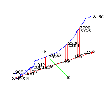
I created the following two images based on the GPS data from our trip using GPSMan, pstoedit, and the GNU plotutils. Elevations are noted in meters in the figures. The gently sloping region and the trail circumnavigating the crater are clearly visible in the three-dimensional depiction of our route.
|
| Three-dimensional Representation of Our Route |
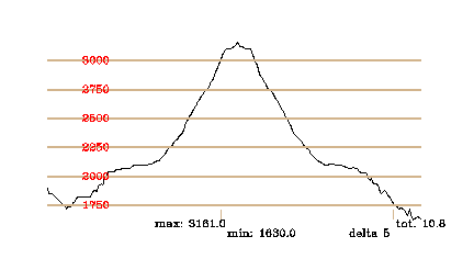 |
| Elevation during Our Climb as a Function of Time |
The raw GPS data is available here. The first few data points are probably spurious and might be artifacts of the satellite acquisition process.
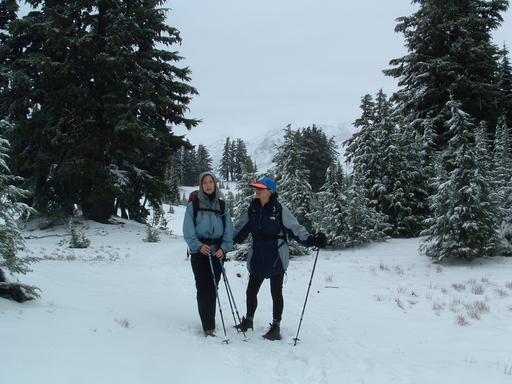
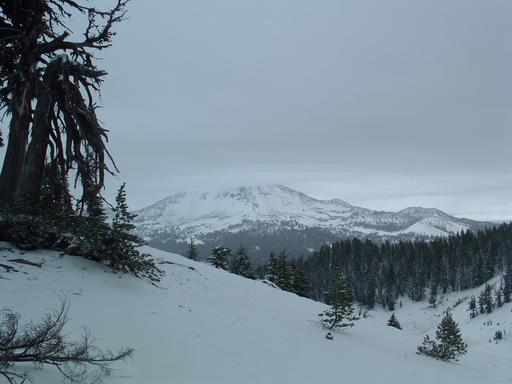
Six days later, on Saturday, October 11, we attempted the same climb with our friend Tricia Dorn, who was visiting from Washington, D.C. The conditions on the mountain were completely different on this trip. It had rained and snowed for most of the intervening days. It also snowed the night before our attempt and it continued to snow and rain throughout our climb. Snow and ice on the road almost prevented us from reaching the trailhead in our car. Fortunately, I had kept the data from the previous weekend on our GPS receiver. This was very helpful since the trail was difficult to discern in places. In the end, our equipment was inadequate for the conditions and we had a wet, frigid climb up to approximately 7900 ft (2408 m) before quickly retreating. When we returned to lower altitudes, we found that the trail had become a stream.
Remarkably, there were quite a few other people making the attempt that day too. It was a little crazy for any of us to be there since the clouds mostly obliterated the views and the two people we met who had made it to the top reported that the summit was like a wind tunnel. We didn't see any chihuahuas that day. They were the smart ones.
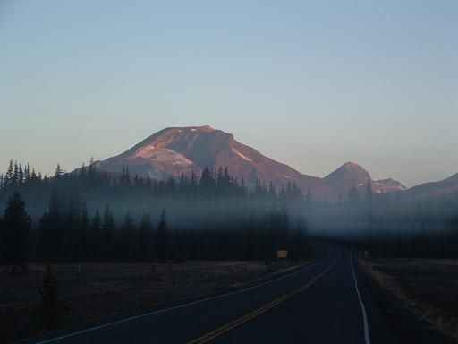 |
| Morning mist and the Sisters (South, Middle, North) just after dawn |
 |
 |
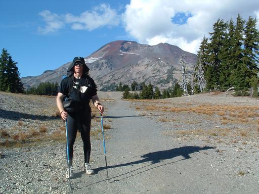
| And so it begins ... | A snowy beginning six days later |
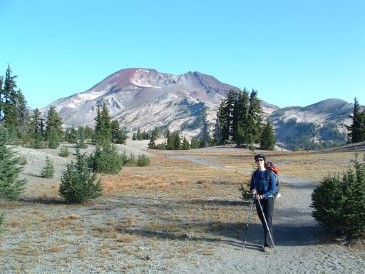 |
| The crater ahead -- Look, ma. No false peaks. |
 |
| Almost the same view six days later |
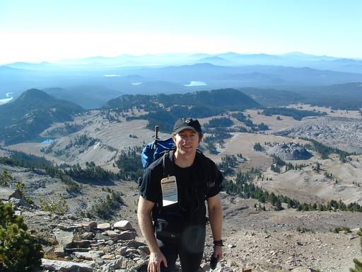 |
| Yes, I really was there too. Notice the hummocks, lava flow, and lava dome in the background. |
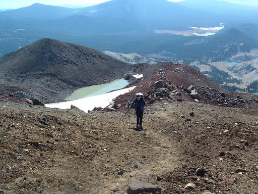 |
| Dawn follows the lip of the moraine surrounding the Lewis Glacier. |
 |
| Dawn winds her way through the last few switchbacks. There's that lava flow again. |
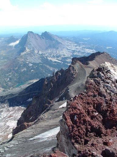 |
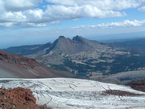
| Rock spires and Broken Top from the crater rim |
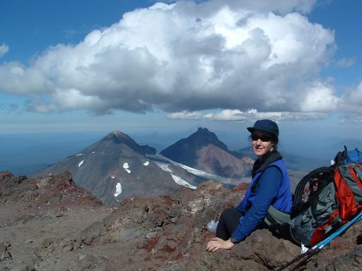 |
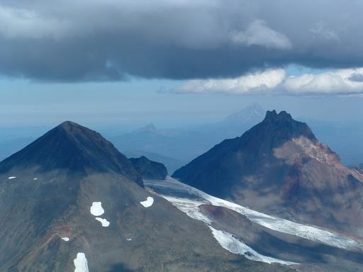
| Dawn admires the Middle and North Sisters with more distant Mt Jefferson and Mt Washington mired in haze. |
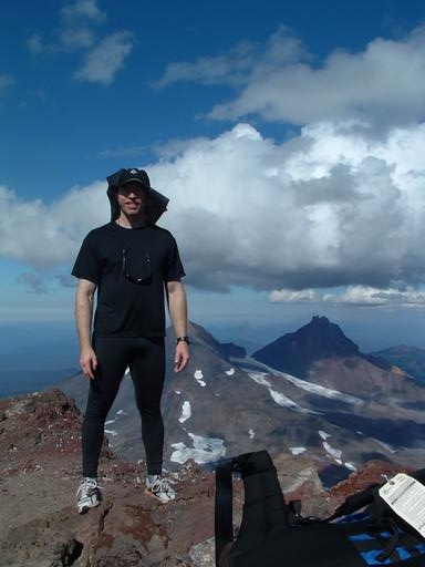 |
| Me too. Me too. |
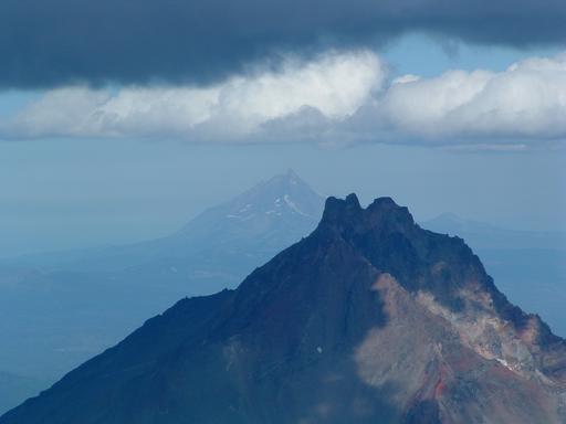 |
| A sunlit Mt Jefferson behind the shadowy North Sister |
 |
| Middle and North Sisters, Washington, Jefferson, and the Hayden and Diller Glaciers |
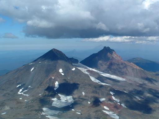 |
| Clouds speckle the mountains with shadow. |
 |
| The world's smallest glacier |
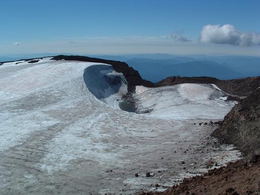 |
| Teardrop Pool, cradled by the summit glacier |
 |
| Crevasses on the Lewis Glacier and Broken Top |
 |
| Broken Top, six days later |
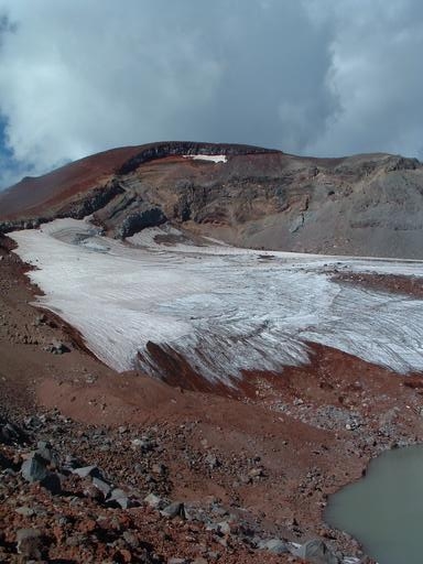 |
| The Lewis Glacier and its moraine |
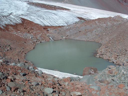 |
| The lake at the base of the Lewis Glacier |
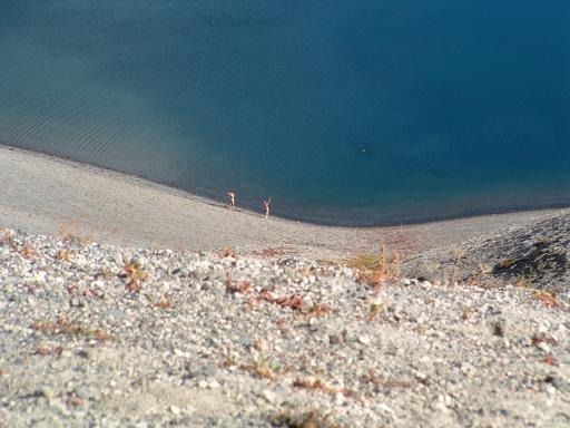 |
| Skinny-Dippers at Moraine Lake |
 |
| The mountain and I bask in the afternoon sun after a wonderful day. |
[Mount Rainier 1993] [Mount Shasta 1993] [Mount Rainier 1994] [Mount Rainier 1999] [Mount Elbert 2003] [Mount St Helens 2003] [Mount Adams 2003] [Glacier Peak 2003] [Mount Hood 2003] [Mountaineering Home] [Diversions Home] [Frames] [Home]
Mark A. Martin <mark@mark-a-martin.us>
Last modified: Thu Nov 20 07:12:55 PST 2003